안녕하세요?
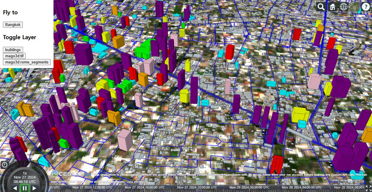
FOSS4G Korea와 FOSS4G-Asia 대회에서 진행한 mago3DTiler 기술 워크샵 교안 공유합니다. mago3DTiler를 활용해 각종 3차원 객체를 OGC 3D Tiles로 변환할 수 있습니다.
1. 공개 데이터인 OvertureMaps(건물), Sentinel(위성영상), NASA DEM(지형)을 인터넷에서 내려받고,
2. 이를 mago3DTiler, mago3DTerrainer를 이용해 OGC 3D Tiles, Quantized Mesh로 변환한 뒤,
3. Cesium.js를 이용해 웹에 가시화하는 내용입니다.
참고하시기 바랍니다.
Korean: https://github.com/Gaia3D/mago3d-doc/blob/main/foss4g/Table_Of_Contents_Ko.md
mago3d-doc/foss4g/Table_Of_Contents_Ko.md at main · Gaia3D/mago3d-doc
Contribute to Gaia3D/mago3d-doc development by creating an account on GitHub.
github.com
English: https://github.com/Gaia3D/mago3d-doc/blob/main/foss4g/Table_Of_Contents_En.md
mago3d-doc/foss4g/Table_Of_Contents_En.md at main · Gaia3D/mago3d-doc
Contribute to Gaia3D/mago3d-doc development by creating an account on GitHub.
github.com
***
I'm very happy to share the mago3DTiler technical workshop materials from the FOSS4G Korea(KR) and FOSS4G-Asia(EN) conferences.
1. Download public datasets such as OvertureMaps(buildings), Sentinel(satellite imagery), and NASA DEM(terrain) from the internet.
2. Convert these datasets into OGC 3D Tiles and Quantized Mesh using mago3DTiler and mago3DTerrainer
3. Visualize them on the web using Cesium.js.
2024년 12월 24일
신상희
'공간정보와 IT > Open Source GIS' 카테고리의 다른 글
| GeoServer 2.27 발표 (0) | 2025.04.13 |
|---|---|
| 국제 FOSS4G 2025 발표자 모집 안내 (0) | 2025.04.13 |
| 오픈소스 mago3DTerrainer 발표 (0) | 2025.03.11 |
| Cesium 개발자 컨퍼런스 발표자 모집 2월 28일 마감 안내 (0) | 2025.02.25 |
| 대한민국 대표 오픈소스, mago3DTiler의 현재와 미래 (0) | 2025.02.08 |
| 가이아쓰리디, FOSS4G-Asia 2024 방콕 대회 참가 (0) | 2024.12.23 |
| State of mago3DTiler, an open source based OGC 3D Tiles creator - FOSS4G Asia 2024 발표 자료 (1) | 2024.12.23 |
| 가이아쓰리디, FOSS4G Korea 2024 플래티넘으로 후원 (0) | 2024.11.02 |
| QGIS에 100개 이상의 배경지도 서비스 추가하기 (1) | 2024.10.01 |
| GeoServer 3 개발을 위한 기금 모금 안내 (0) | 2024.09.19 |


